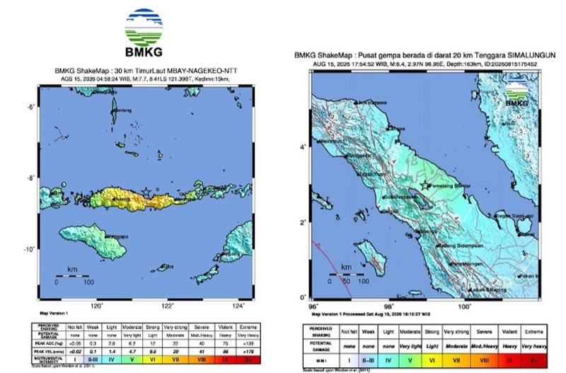
In contrast, this earthquake originated at a much shallower depth (15 km), causing relatively severe physical damage to infrastructure and triggering a tsunami observed as far as the coasts of South and Southeast Sulawesi.
Aftershock activity has been distributed north of Flores Island, with magnitudes ranging from M 2.5 to M 6.2. Monitoring data indicates that the trend of recorded aftershocks has not yet shown a significant decline.
Based on the shake intensity map, the BMKG recorded peak shaking reaching MMI scale VII in the Aesesa area (Nagekeo Regency), Riung (Ngada Regency), and Ambai City, as well as through direct micro-observations in the Manggarai and Ruteng areas. MMI scale VI was recorded in Wolowae (Nagekeo) and Bajawa City, while MMI scale V was felt in several surrounding areas.
The United States Geological Survey (USGS) reported that the Flores Sea earthquake—with a magnitude of M 7.7—occurred on Saturday morning (August 15) off the northern coast of NTT, caused by a shallow-depth thrust fault.
This powerful earthquake struck a seismically active region dominated by the convergence of the Australian and Sunda plates.
By Saturday afternoon, more than 250 aftershocks had occurred.
The National Disaster Management Agency (BNPB) recorded dozens of fatalities across several areas of NTT, along with damage to at least 90 buildings.