
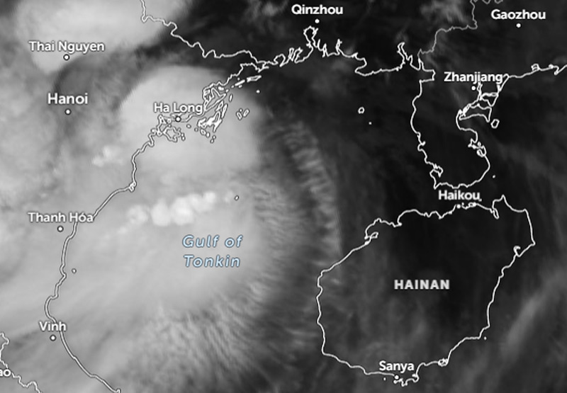
Darilaut – From its formation on the afternoon of Friday (Aug 21) through the early hours of Monday (Aug 24), Tropical Storm Narra remained within the Gulf of Tonkin (also known as Beibu Wan). The storm brought strong wind gusts, heavy rain, and rough seas.
The Gulf of Tonkin is situated between northern Vietnam, southern China, and Hainan Island, covering an area of approximately 126,250 square kilometers (48,750 square miles).
The distance between the coast of Ha Long in northern Vietnam and the coast of the Leizhou Peninsula is 270 km, while the distance from Ha Long to Haikou on Hainan Island is 340 km.
For three days, Tropical Storm Narra moved slowly across this confined gulf.
At 2:00 AM on Monday, the center of Tropical Storm Narra was located approximately 240 kilometers west-northwest of Haikou. According to an information bulletin issued by the Hong Kong Observatory (HKO) on Monday, the storm was expected to move slowly and linger in the Beibu Wan area.
Earlier, at 10:00 PM on Sunday (Aug 23), the storm’s center was also located about 240 kilometers west-northwest of Haikou; by Sunday afternoon, it had been 280 kilometers west-northwest of Haikou.
The storm was forecast to move slowly and remain within the Beibu Wan region.
The HKO projected that Tropical Cyclone Narra would gradually turn northeastward between Monday and Tuesday (Aug 25), moving closer to the Leizhou Peninsula.
The Japan Meteorological Agency (JMA) reports that Tropical Storm Narra is nearly stationary in the Gulf of Tonkin.
The system packs maximum sustained winds of 18 meters per second (35 knots) near its center, with peak instantaneous wind speeds reaching 25 meters per second (50 knots).
Narra—designated as Typhoon No. 19 by Japan—has a central atmospheric pressure of 992 hPa (hectopascals).
An area of strong winds (30 knots or greater) extends 220 km (120 nautical miles) to the southwest and 165 km (90 nautical miles) to the northeast of the center, the JMA stated.
According to the Joint Typhoon Warning Center (JTWC), Narra is located 235 km east-southeast of Hanoi, Vietnam, and has been drifting southward at 2 km/h (1 knot) over the past six hours.
Maximum significant wave heights are reaching 4 meters (13 feet), the JTWC reported.
The JTWC forecasts that Narra will move slowly southward over the next 24 hours, as it is situated amidst conflicting steering currents.
Narra’s actual path is likely to be erratic during this period—a behavior not fully captured by the JTWC forecast.
In approximately 36 hours, a near-equatorial ridge to the south is expected to strengthen southeast of Narra, causing the storm to turn eastward and subsequently northward toward the southern coast of China.
Regarding intensity, the JTWC projects that Narra will maintain its current strength of 75 km/h (40 knots) for the next 36 hours, as wind shear remains relatively low.
After 36 hours, easterly wind shear and dry air are expected to increase, causing the system to weaken as it approaches the Chinese coast.
The JTWC predicts that Narra will dissipate rapidly after making landfall in approximately 3 days.
Track guidance from various models still shows uncertainty due to conflicting steering influences, the JTWC said.