
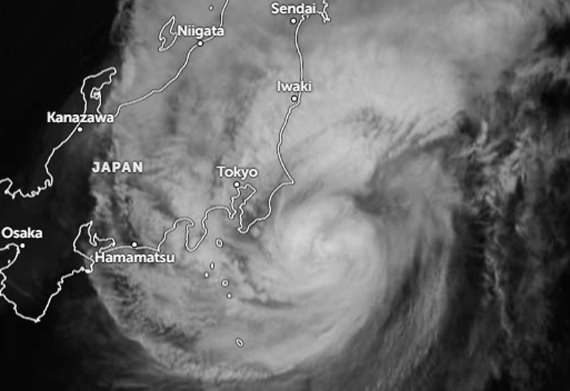
Darilaut – Typhoon Dujuan was located near Tokyo, Japan, on Monday (Sept. 21) evening.
Dujuan was situated 130 km southeast of Tokyo and was expected to remain at sea, moving northeast across the North Pacific Ocean on Monday night.
The Japan Meteorological Agency (JMA) reported that Dujuan was heading northeast at a speed of 40 km/h (21 knots).
The central atmospheric pressure was 960 hPa (hectopascals), according to the JMA.
The system was packing maximum sustained winds of 40 meters per second (75 knots) near its center, with peak instantaneous wind speeds reaching 55 meters per second (105 knots).
The storm-force wind area (speeds of 50 knots or higher) extended 185 km (100 nautical miles) from the center, while the gale-force wind area (speeds of 30 knots or higher) extended 650 km (350 nautical miles) to the east and 440 km (240 nautical miles) to the west, the JMA reported.
The Hong Kong Observatory (HKO) stated on Monday afternoon that the center of Typhoon Dujuan was located approximately 280 kilometers south of Tokyo. The typhoon was forecast to move northeast at about 30 km/h across waters south of Japan’s Honshu Island.
Maximum significant wave heights reached 9.8 meters (32 feet), according to the Joint Typhoon Warning Center (JTWC).
The JTWC projected a brief period of intensification, with peak winds reaching 140 km/h (75 knots), driven by favorable thermodynamic and synoptic conditions.
This temporary intensification phase was supported by Dujuan’s ability to briefly shield itself from detrimental dry-air intrusion while capitalizing on strong poleward outflow, the JTWC noted. After passing its point of closest approach to Yokosuka, the storm is expected to move across the edge of the Kuroshio Current—where thermal conditions remain favorable (temperatures of 28–29°C)—over the next 12 hours.
However, according to the JTWC, the extratropical transition (ETT) process is set to begin as thermodynamic conditions deteriorate due to rapidly dropping sea surface temperatures, persistent dry air advection, and destructive wind shear exceeding 40 knots within a 36-hour period.
Dujuan, Japan’s 25th typhoon of the season, is bringing heavy rains capable of triggering landslides and flooding.
Millions of people have been urged to evacuate, while hundreds of flights have been canceled. Transport services, as well as various events and activities, have been disrupted as the typhoon approaches.