
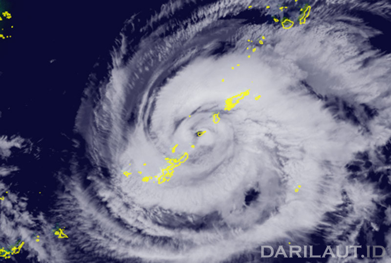
Darilaut – Typhoon Saudel made landfall on the coast of Fujian Province, between the shores of Zhangpu County and Dongshan County, on Thursday (Sept 3) morning.
This marked the fifth landfall in Typhoon Saudel’s journey, which spanned over 7,000 km starting near Micronesia in the Pacific Ocean.
Typhoon Saudel followed a long trajectory. According to tracking data from Zoom.earth and the Japan Meteorological Agency (JMA), the tropical cyclone began developing from a disturbance and intensified into a tropical storm near Micronesia on the afternoon of Wednesday (Aug 19).
Saudel then moved generally northwest, approaching Guam and passing north of the Northern Mariana Islands.
Subsequently, the typhoon moved toward southern Japan. Saudel made landfall—or passed extremely close—to Okinoerabu Island, Japan, around midnight on Tuesday (Aug 25).


The typhoon moved west-northwest toward the East China Sea, bringing strong winds, heavy rain, and high waves to the small islands of southwestern Japan on Tuesday and Wednesday (Aug 26).
After crossing the East China Sea, Saudel made landfall twice on the coast of Zhejiang Province. The first landfall occurred on the coast of Yuhuan City—administered by Taizhou City, East China—on the morning of Friday (Aug 28).
Saudel passed near Wenzhou, Zhejiang, and moved inland across Fujian, Jiangxi, and Guangdong provinces before returning to the sea to make its fourth landfall on Hainan Island, southern China.
Saudel has not yet fully dissipated. After passing over Hainan Island, Saudel moved east and northeast, regenerating into a tropical storm in the South China Sea before making its fifth landfall on the coast of Fujian.
The Hong Kong Observatory (HKO) stated that Saudel had moved across the interior of eastern Guangdong and was slowly weakening.
Saudel is expected to move closer to the Pearl River Estuary region on Friday (Sept 4), though there is uncertainty regarding the rate of its weakening.
According to the JMA, Saudel has been moving northwest at a speed of 20 km/h (11 knots).
Maximum sustained wind speeds are 18 meters per second (35 knots), with peak instantaneous gusts reaching 25 meters per second (50 knots).
Areas with strong winds of 30 knots or more extend 330 km (180 NM) to the southeast and 280 km (150 NM) to the northwest of the center, according to the JMA.
The Joint Typhoon Warning Center (JTWC) reported that available satellite and radar data indicate the center of circulation has made landfall near Dongshan Port in southeastern China.
Over the past six hours, Saudel was located 367 km east-northeast of Hong Kong and moved west-northwest at 19 km/h (10 knots), the JTWC said.
The storm is expected to weaken and dissipate as it moves westward over land.