
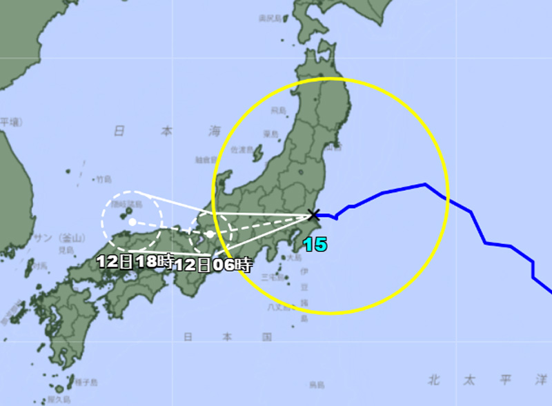
Darilaut – Tropical Storm Chan-hom made landfall on the east coast of Honshu Island, Japan, on Tuesday (Aug 11) evening.
The storm made landfall northeast of Tokyo, in the area between Iwaki and Kamisu.
Following landfall, Chan-hom is expected to track north-northwest, passing north and northwest of Tokyo.
The Japan Meteorological Agency (JMA) reported that as of 8:00 PM local time on Tuesday, Chan-hom was moving westward at a speed of 20 km/h (12 knots).
The system had a central atmospheric pressure of 980 hPa (hectopascals).
According to the JMA, maximum sustained winds near the center were 25 meters per second (50 knots), with peak instantaneous wind gusts reaching 35 meters per second (70 knots).
The JMA noted that the area of strong winds (30 knots or greater) extended 500 km (270 nautical miles) to the northeast and 330 km (180 nautical miles) to the southwest of the center.
Over the past six hours, Chan-hom had been moving west-southwest at 24 km/h (13 knots). Maximum significant wave heights reached 7.6 meters (25 feet), according to the Joint Typhoon Warning Center (JTWC).
The JTWC stated that Chan-hom is expected to remain over land for less than 24 hours before moving back over the waters of the Sea of Japan within 12 to 24 hours; it is then projected to remain over water until it eventually weakens and dissipates within 36 hours.
Upon returning to the waters of the Sea of Japan, Chan-hom is expected to encounter highly unfavorable environmental conditions, preventing it from recovering from the severe weakening it underwent while crossing the mountainous terrain.