
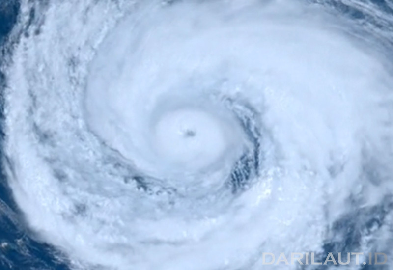
Darilaut – Typhoon Dolphin struck the small islands of Amami and Okinawa in southwestern Japan on Friday morning (August 7).
Dolphin had weakened from a super typhoon but retained the intensity of a strong typhoon. The system brought strong winds, heavy rain, and high waves.
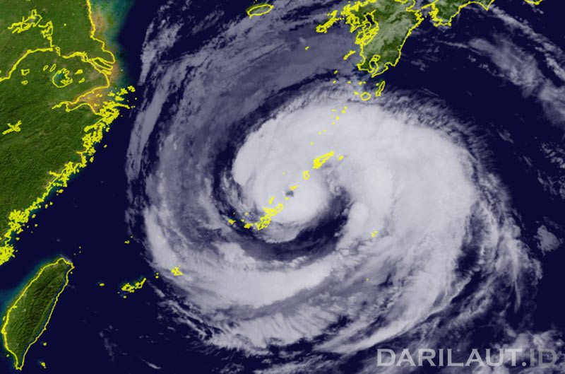
The center (core) of Dolphin passed near Wadomari on Okinoerabu Island, part of the Amami Islands in Kagoshima Prefecture, Japan.
Satellite imagery from the Japan Meteorological Agency (JMA) and Zoom.earth showed Dolphin’s eyewall positioned between Okinoerabu Island and Yoron Island—near other small islands in the Okinawa group—at 8:40 a.m. on Friday.
At 9:00 a.m. local time, the strong typhoon was moving westward at a speed of 25 km/h (14 knots).
The system had a central air pressure of 950 hPa (hectopascals), according to the Japan Meteorological Agency.
Dolphin packed maximum sustained winds of 40 meters per second (75 knots) near its center, with peak instantaneous wind speeds reaching 55 meters per second (105 knots).
The area of storm-force winds (50 knots or higher) extended 330 km (180 nautical miles) to the northeast and 185 km (100 nautical miles) to the southwest.
The area of strong winds (30 knots or higher) extended 650 km (350 nautical miles) to the northeast and 560 km (300 nautical miles) to the southwest, the JMA reported.
According to the Hong Kong Observatory (HKO), the typhoon is forecast to move westward at approximately 18 km/h across the Ryukyu Islands region and into the East China Sea.
Earlier, at 2:00 a.m. on Friday, the center of Typhoon Dolphin was located approximately 270 kilometers east-northeast of Okinawa. As of 11:00 p.m. Thursday, the center of Dolphin was located approximately 330 kilometers east of Okinawa.
Dolphin is set to move across the Ryukyu Islands and the East China Sea. Subsequently, the cyclone will move toward the Zhejiang region and northern Fujian, according to the HKO.
Maximum significant wave heights have reached 12.2 meters (40 feet), according to the Joint Typhoon Warning Center (JTWC).

The JTWC forecasts that the system will continue moving almost due west over the next 60 hours.
Its forward speed is expected to slow slightly between 36 and 60 hours from now due to a weakening steering gradient between two ridge features.
After 60 hours, steering conditions will become more complex due to the passage of a mid-latitude low-pressure trough to the north, creating uncertainty regarding a potential recurving path.
Dolphin is expected to make landfall in eastern China in about three days as it begins to turn northwestward.
Its intensity is expected to remain steady at around 150 km/h (80 knots) for the next two days, the JTWC stated.
Thereafter, according to the JTWC, a trend of sustained weakening will occur due to low ocean heat content and the storm’s proximity to the Chinese mainland.