
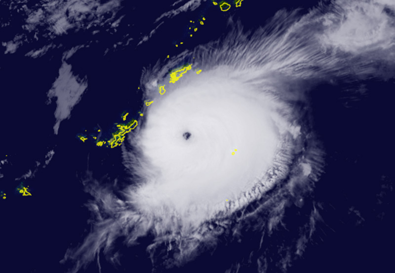
Darilaut – Typhoon Surigae rapidly intensified into a “Very Strong Typhoon” east of Okinawa on Sunday.
Typhoon Surigae is currently located 190 km east of Okinawa, 230 km south-southeast of Amami, and 578 km south-southwest of Kagoshima.
An eyewall has formed and is clearly visible.
The Japan Meteorological Agency (JMA) stated on Monday that Surigae has a central atmospheric pressure of 945 hPa (hectopascals).
The system packs maximum sustained winds of 50 meters per second (95 knots) near its center, with peak instantaneous wind speeds reaching 70 meters per second (135 knots).
Surigae is moving east-northeast at a speed of 15 km/h (9 knots).
The storm-force wind area (50 knots or higher) extends 85 km (45 nautical miles) from the center, while the gale-force wind area (30 knots or higher) extends 280 km (150 nautical miles) to the southeast and 165 km (90 nautical miles) to the northwest.
The Hong Kong Observatory (HKO) reported that the system—previously a Severe Tropical Storm—rapidly intensified into a super typhoon on Saturday.
As of 11:00 PM Saturday, the center of Surigae was located approximately 170 kilometers east of Okinawa.
The storm is forecast to move northeast at about 15 km/h across the region surrounding the Ryukyu Islands, according to the HKO.
According to the Joint Typhoon Warning Center (JTWC), Surigae has been moving northeast at a speed of 17 km/h (9 knots). Maximum significant wave heights reached 13.7 meters (45 feet).
The JTWC forecasts that over the next 24 hours, wind shear will increase to 35 km/h (20 knots) and trigger an influx of dry air from the northern side of the typhoon, initiating a steady weakening trend.