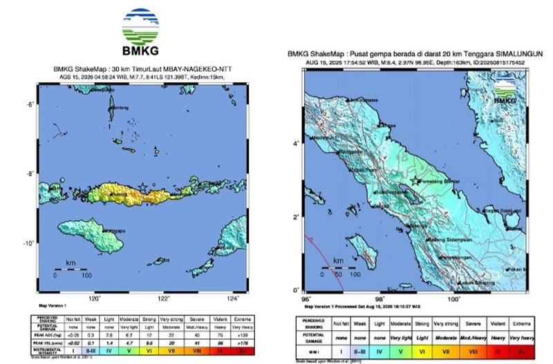
A second earthquake, with a magnitude of M 6.4, occurred onshore in North Sumatra on Saturday afternoon (August 15). The earthquake was strongly felt for 30 seconds in Simalungun Regency, Medan City, and Pakpak Regency. Meanwhile, in Central Tapanuli Regency, the quake was strongly felt for 10 seconds.
According to the BMKG, the earthquake’s epicenter was located at 2.97° N latitude and 98.95° E longitude, at a depth of 163 kilometers. The quake originated inland and posed no tsunami threat.
The North Sumatra Provincial Regional Disaster Management Agency (BPBD) reported that the earthquake was felt in several areas, including Simalungun Regency, Medan City, Pakpak Bharat Regency, and Central Tapanuli Regency.
The United States Geological Survey (USGS) recorded a magnitude 6.9 earthquake located 15 km north-northwest of Pematangsiantar. The earthquake occurred at a depth of 172.5 km.
Automated USGS analysis identified the nearest locations as Pematangsiantar (15.3 km / 9.5 miles), Pekan Bahapal – Simalungun (17.9 km / 11.1 miles), Tebing Tinggi (31.6 km / 19.6 miles), Parapat – Simalungun (47.9 km / 29.8 miles), and Medan (67.6 km / 42 miles).