
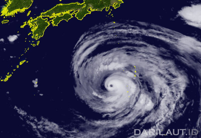
Darilaut – After crossing the Ogasawara Islands, Typhoon Dolphin is currently south of Tokyo, moving towards Okinawa Island on Wednesday (August 5). The system is bringing waves with a maximum height of 15.2 meters (50 feet).
Dolphin has weakened from a super typhoon, but maintains its intensity as a very strong typhoon.
As of early Wednesday morning, Typhoon Dolphin was located 1,140 km south of Tokyo and 1,170 km east of Okinawa.
The system is moving west at 15 km per hour (9 knots). The air pressure at its center is 945 hPa (hectopascals), according to the Japan Meteorological Agency (JMA).
According to the JMA, Dolphin has a maximum sustained wind speed around the center of 45 meters per second (85 knots), while the maximum instantaneous sustained wind speed is 60 meters per second (120 knots).
A storm surge with winds of 50 knots or more is expected across a 185-km (100 NM) area, and strong winds with winds of 30 knots or more are forecast across a 560-km (300 NM) area.
The Hong Kong Observatory (HKO) said Tropical Cyclone Dolphin in the western North Pacific will move across waters south of Japan today and tomorrow (Thursday, August 6). The system will move across the Ryukyu Islands in the East China Sea later this week.
However, according to the HKO, there are obstacles in its further movement, with a greater possibility of turning northward over the East China Sea toward eastern China.
Typhoon Dolphin has been moving westward at 22 km per hour (12 knots) for the past six hours. The maximum significant wave height was 15.2 meters (50 feet), according to the Joint Typhoon Warning Center (JTWC).
The JTWC expects the system’s travel speed to slow to only 5–10 km per hour (4–5 knots) once the system moves into the East China Sea.
In the final forecast period, the system will begin to gradually slow toward the northwest.
Dolphin is expected to make landfall in Okinawa in about three days before moving out into the East China Sea, the JTWC said.
Regarding intensity, the JTWC said the system appears to have reached a stable state, achieving a balance between competing environmental factors.
The JTWC envisions the system weakening slightly over the next 12 hours, then maintaining its intensity for the next 36 hours before beginning a gradual weakening trend until it makes landfall in Okinawa.
This is primarily due to slightly lower sea surface temperatures due to oceanic upwelling and reduced upper-layer outflow.
The system will then weaken more rapidly as it slows and upwelling becomes more significant.
While its intensity is expected to continue to decrease, the wind field is expected to continue expanding, with strong winds expected to cover an area of nearly 1,111 km in the East China Sea over the next five days.