
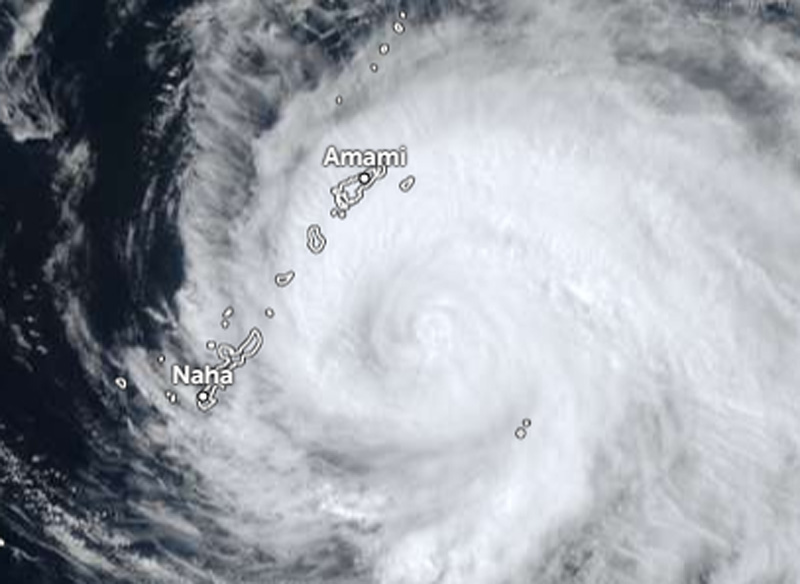
Darilaut – Typhoon Saudel is set to strike the Amami and Okinawa islands in southwestern Japan on Wednesday (August 26).
Japan’s 18th typhoon of the season was moving west-southwest on Tuesday (August 25) afternoon, bringing strong winds, heavy rain, and high waves.
Saudel is likely to pass near or make landfall at Wadomari on Okinoerabu Island. Its path is similar to that of Typhoon Dolphin, which struck Amami and Okinawa on Friday, August 7.
As of Tuesday afternoon, Saudel was located 183 km east-northeast of Okinawa Island, 165 km south-southeast of Amami Island, and 520 km south-southwest of Kagoshima.
The Japan Meteorological Agency (JMA) reported that the system packs maximum sustained winds of 40 meters per second (80 knots) near its center, with peak instantaneous wind speeds reaching 60 meters per second (115 knots).
The powerful typhoon is moving west-northwest at a speed of 20 km per hour (11 knots).
Saudel has a central atmospheric pressure of 950 hPa (hectopascals), according to the JMA.
The JMA stated that the storm-force wind area (speeds of 50 knots or higher) extends 130 km (70 nautical miles) from the center, while the gale-force wind area (speeds of 30 knots or higher) extends 390 km (210 nautical miles) to the northeast and 330 km (180 nautical miles) to the southwest.
Maximum significant wave heights are reaching 13.7 meters (45 feet), according to the Joint Typhoon Warning Center (JTWC).
The JTWC has warned that this is a dangerous weather system. Potential hazards include destructive winds and heavy rainfall capable of triggering landslides and flash floods.
Additionally, the storm poses risks of storm surges and high ocean waves. Saudel has been moving west-northwest at a speed of 22 km/h (12 knots) over the past six hours.
The Hong Kong Observatory (HKO) stated on Tuesday afternoon that the severe typhoon Saudel was located approximately 300 kilometers east of Okinawa.
The typhoon is expected to move west-northwest at about 18 km/h toward the Ryukyu Islands, the HKO said.
After passing the small islands of southwestern Japan, Saudel will approach the coast of China between Fujian and Zhejiang in the coming days.
The JTWC forecasts that Typhoon Saudel will continue moving northwest. Saudel is expected to cross the Ryukyu Islands within the next 12 hours with maximum sustained winds of 155 km/h (85 knots).
The system will slow down while over the East China Sea in the next one to two days. Saudel will likely shift toward the southwest, heading for the coast.
The typhoon is expected to make landfall in eastern China in about three days and is predicted to dissipate within five days.
The JTWC projects that environmental conditions will deteriorate throughout the forecast period, with wind shear ranging from 35–55 km/h (20–30 knots) leading up to landfall; this will drive additional dry air into the storm’s core.
Sea surface temperatures and ocean heat content will remain favorable for the next 72 hours, slightly offsetting the impact of wind shear and dry air.