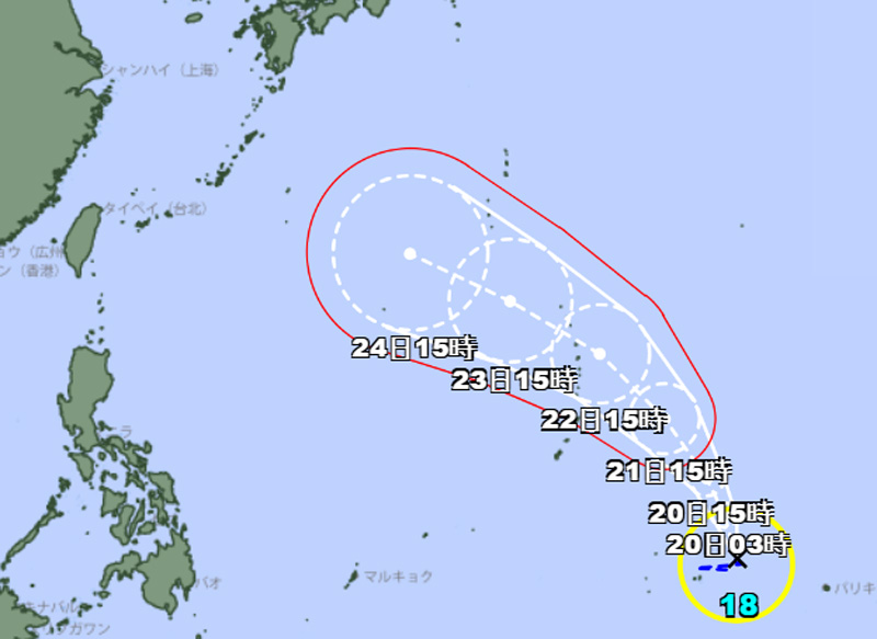
Darilaut – Tropical Storm Saudel formed near Micronesia in the Pacific Ocean on Wednesday afternoon (August 19). This tropical cyclone is expected to pass north of the Northern Mariana Islands and head toward southern Japan.
Saudel—Japan’s 18th typhoon of the season—was moving slowly northwestward as of Wednesday afternoon.
The system has a central atmospheric pressure of 1000 hPa (hectopascals), according to the Japan Meteorological Agency (JMA).
Saudel packs maximum sustained winds of 20 meters per second (40 knots) near its center, with peak instantaneous wind speeds reaching 30 meters per second (60 knots).
The JMA reports an area of strong winds—speeds of 30 knots or greater—extending 330 km (180 nautical miles) to the south and 280 km (150 nautical miles) to the north of the center.
The system is located 259 km east-northeast of Chuuk—a state within the Federated States of Micronesia—and has been moving west-southwest at 7 km/h (4 knots) over the past six hours.
Maximum significant wave heights are reaching 4 meters (13 feet), according to the Joint Typhoon Warning Center (JTWC).
The JTWC notes that the area of strongest winds, located in the southeastern quadrant, is expected to continue rotating cyclonically, likely driving a southwestward movement.