
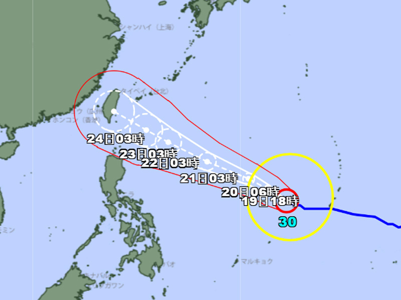
The Joint Typhoon Warning Center (JTWC) indicates that maximum significant wave heights could reach 14 meters (46 feet).
At the same time, the cyclone’s forward speed has slowed slightly due to the formation of a col—a meeting point between two high-pressure systems—to the north, which has weakened the steering gradient.
Regarding intensity, the JTWC indicates that an eyewall replacement cycle appears to have concluded, and general atmospheric conditions are now favorable for a resumption of intensification.
Over the next two days, the system will traverse waters with some of the highest ocean heat content in the Western Pacific, providing a robust source of thermodynamic energy to fuel continued intensification, according to the JTWC.
Halaman 2 dari 2