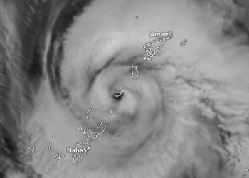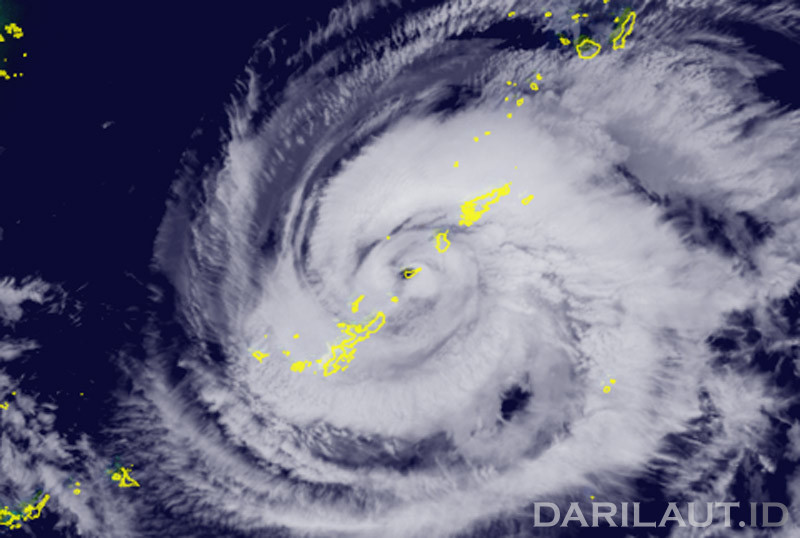
Darilaut – Typhoon Saudel made landfall on—or passed very close to—Okinoerabu Island, Japan, around midnight on Tuesday (August 25). The typhoon is moving west-northwest toward the East China Sea.
The typhoon brought strong winds, heavy rain, and high waves to the small islands of southwestern Japan on Tuesday and Wednesday (August 26).
Data from the Japan Meteorological Agency (JMA) storm track, the Himawari weather satellite, and the Zoom.earth weather app indicate that the center (core) of Typhoon Saudel was located over Okinoerabu Island.
As of midnight Tuesday, Typhoon Saudel was situated over Okinoerabu Island, located 60 km north-northeast of Okinawa Island and 100 km southwest of Amami.
Earlier on Tuesday, Saudel was positioned 183 km east-northeast of Okinawa Island, 165 km south-southeast of Amami Island, and 520 km south-southwest of Kagoshima.
Typhoon Saudel’s path is similar to that of Typhoon Dolphin, which passed over Wadomari and struck Amami, Okinawa, and other small islands on Friday, August 7.
The JMA reported that Typhoon Saudel is moving west-northwest at a speed of 20 km/h (11 knots).
The typhoon has a central atmospheric pressure of 950 hPa (hectopascals).
Typhoon Saudel packs maximum sustained winds of 40 meters per second (80 knots) near its center, with peak instantaneous wind speeds reaching 60 meters per second (115 knots).