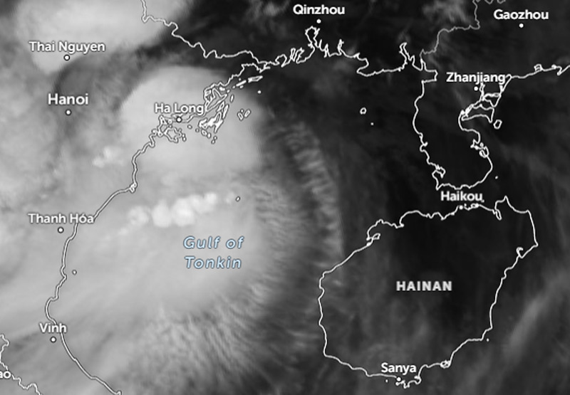
Darilaut – From its formation on the afternoon of Friday (Aug 21) through the early hours of Monday (Aug 24), Tropical Storm Narra remained within the Gulf of Tonkin (also known as Beibu Wan). The storm brought strong wind gusts, heavy rain, and rough seas.
The Gulf of Tonkin is situated between northern Vietnam, southern China, and Hainan Island, covering an area of approximately 126,250 square kilometers (48,750 square miles).
The distance between the coast of Ha Long in northern Vietnam and the coast of the Leizhou Peninsula is 270 km, while the distance from Ha Long to Haikou on Hainan Island is 340 km.
For three days, Tropical Storm Narra moved slowly across this confined gulf.
At 2:00 AM on Monday, the center of Tropical Storm Narra was located approximately 240 kilometers west-northwest of Haikou. According to an information bulletin issued by the Hong Kong Observatory (HKO) on Monday, the storm was expected to move slowly and linger in the Beibu Wan area.
Earlier, at 10:00 PM on Sunday (Aug 23), the storm’s center was also located about 240 kilometers west-northwest of Haikou; by Sunday afternoon, it had been 280 kilometers west-northwest of Haikou.
The storm was forecast to move slowly and remain within the Beibu Wan region.
The HKO projected that Tropical Cyclone Narra would gradually turn northeastward between Monday and Tuesday (Aug 25), moving closer to the Leizhou Peninsula.