One hour later, Saudel made a second landfall on the coast of Wenzhou City, Zhejiang.
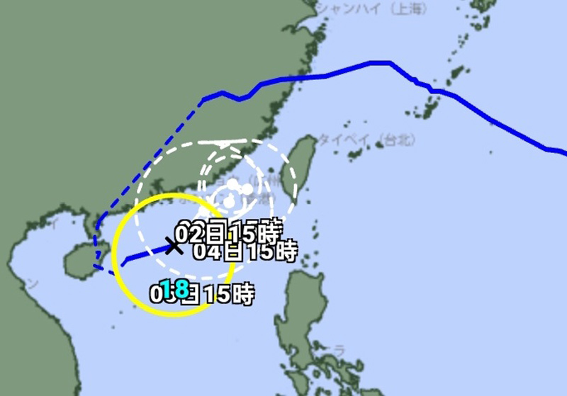
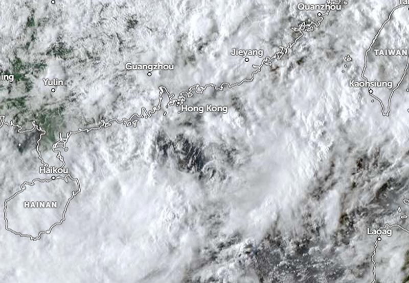
Saudel moved inland across Zhejiang and Fujian, then turned west-southwest, southwest, and south, eventually reaching Hainan Island and crossing the South China Sea. Saudel will move eastward across the northern part of the South China Sea, gradually approaching the coast of eastern Guangdong today and tomorrow (Wednesday, 2/9), according to the Hong Kong Observatory (HKO).
The HKO stated that due to the combined influence of Saudel and the northeast monsoon, weather conditions along the South China coast will become windier, accompanied by rain, strong gusts, and high waves.
On Thursday (3/9), Saudel is expected to remain in the vicinity of the northeastern South China Sea and the eastern Guangdong coast.
However, the HKO notes there is uncertainty regarding its movement and intensity.
The Japan Meteorological Agency (JMA) reported that Saudel is moving east-northeast at a speed of 20 km/h (12 knots).
The system has a central pressure of 994 hPa (hectopascals).
Saudel packs maximum sustained winds of 18 meters per second (35 knots), with maximum instantaneous wind speeds of 25 meters per second (50 knots).
According to the JMA, the area of strong winds (30 knots or higher) extends 390 km (210 nautical miles) to the south and 280 km (150 nautical miles) to the north.